Day Sixteen: Bridge Shrines; Uwajima to Kuma Kogen
Weather: OMG it’s hot! And sunny. Soaked at 4:30.
Up and at ‘em at six am, around the corner at ten to seven for the regular combini obento and can o’ café.
Then a scenic ride through downtown Uwajima, famous for bullfights and huge mukade (it’s the heat and humidity). I saw the one above on Oshima Island in June. It was crossing the four lane highway. It knew I was there and was unperturbed. It waited until the traffic was clear then scuttled across the road. I kept hoping a car would come along but none did. This one was five inches long in early June; by September I expect it would have been somewhat larger.
Then I hied out route 56 to 57, and then alongside 31 on a smaller road. I prefer to use the smaller roads when I can, it’s more restful and I can spend more time looking at the landscape (as opposed to dodging giant dump trucks and semis).
 Ryukoji
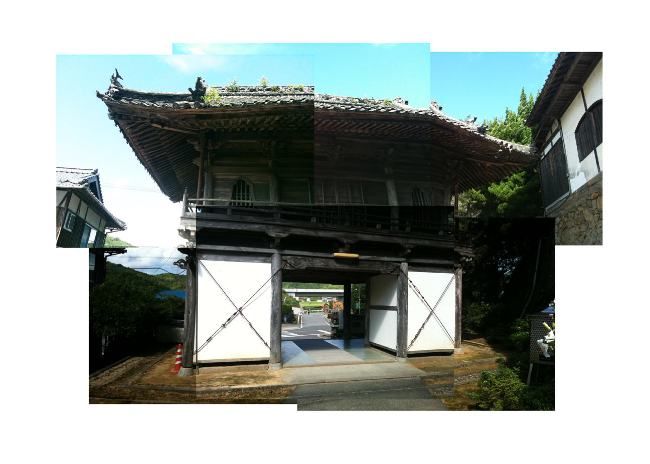
I found Temple 41, Ryukoji, ten or 11 kilometres along. Not easy to find at first, it seemed dominated by a jinja, and appeared to have no mon. I wonder what happened to it; perhaps the temple never had one. There was also an interesting clearcut just behind it on the hill. I didn’t see any bicycle henro, but did see a group of arukihenro. They seemed somewhat aloof.

Temple 42, Butsumukoji, is just 2.6 kilometres further along route 31 on my map.


I came across this retired locomotive, C12231, somewhere along the way. I've forgotten just where; before Uchiko, I think.

Temple 43, Meisekiji, is 10.6 kilometres further along – on the other side of a mountain range. The Hanaga tunnel cuts through the pass.

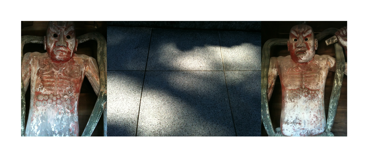
Meisekiji had a couple of beautiful, weathered old Shinto shrines in the trees, moss covered rocks and gravestones all around, and this series of small shrines. They are about 3 to 4 feet to a side. I had no idea what they enshrined, or why there should be so many of them, most apparently enshrining similar objects, which look like metal discs, suspended. I suspected they were Shinto, but could they possibly be representations of Ameterasu's mirror? I had no idea, the discs simply suggested the sun and mirror symbols. Subsequently, however, I found this entry describing these 12 shrines as 'Kumano' in origin. According to this wikipedia article, Kumano shrines are a blending of Buddhist sacred images with older Shinto gods.

Then there’s a good long hike up to temple 44, on the Shikoku plateau. The map shows it as 67.2 kilometres. But there’s a lot to see along the way, as the road winds through the usual farmlands, but also through Ozu, a nice small city with a bangai temple, and then through Ichiko, with it’s restored edo era streets.

Toyogahashi Eitokuji is a bangai (un-numbered) temple in Ozu. There are (I think) twenty bangai temples; Mikurado, Kukai’s cave on Cape Muroto, is a bangai temple – and also one of the holiest places in the pilgrimage. This is another special temple for Kukai, commemorating the night he spent under a bridge at this place 1200 years ago. I wonder if this site and event was the basis for the practice of walking henro never to tap their sticks on bridges as they cross, for they may disturb Kukai’s rest.


There is a temple beside the bridge (which is a modern four lane structure), and a stairway leading down. Under the bridge is another shrine. It’s way cool! There was an older man sitting down there, in the shade, feeding the pigeons, and, from the presence of a rather large school of catfish around him, the fish. He seemed a little suspicious of me, but I smiled and said hello anyway, and did my prayers, and took my pictures.


Around 1pm, dazed by the heat, in Uchiko, I stopped into a Marunaka supermarket. I needed lunch, a soft drink, or the air conditioning, all, it seemed, in equal measure. While I stood there for a moment, monitoring the drop in my body temperature (I could feel it; what relief!) a 30 - something woman ran up to me and asked me if I was a pilgrim. It was a rather obvious question; I was wearing my pilgrim vest and sash, as I always did unless eating or going to the bathroom - but she was just being polite.
Still dazed, I stared back at her for a moment, before collecting my wits and answering, as politely as I could, that, well, yes, I was...whereupon she handed me four or five candies as o-settai. I found myself quite touched, broke out in a big smile and thanked her profusely. She smiled back and ran away. It made my day.
Much refreshed, I continued, leaving rte. 56 and climbing along the Odagawa on rte. 379 toward Kuma. But I missed Uchiko! Next time I will stop there. If the pilgrim is interested in Japanese architecture, this place is a treasure trove of restored buildings and streets, as individualistic yet representative as Gion in Kyoto.
I came upon a walking pilgrim who was pushing a loaded cart, as big as he was, up the pass to Kuma Kogen! I waved but he ignored me, lost, I assume, in the effort to get up the mountain. It must have been a miserable push in the intense heat. In hindsight, it would have been nice to stop and given him some water…but I was busy with the climb myself. This ascent is about 13 kilometres long, up onto the plateau. I believe I saw a sign naming it the Sato Pass, though my map book identifies it as the Mayumi-toge...it's a long steep haul.

Being a cyclist, I found I had to continue east on 380 to where it meets 33, and turn left and northward up the hill along the Kuma-gawa for a few kilometres to reach Kuma Kogen, a small farming and logging town, with a popular ski hill nearby. I’d been here a couple of times before with my friends Katsuhiko and Chiomi Ochi, and their boys, Kazuma, Toshiki and Ryota, to watch them play baseball. The walking trails cuts across the mountains at this point; it would be an interesting hike!
I made it to Kuma around 4:45, soaked by a squall in the last few kilometres, and decided to leave Temple 44 for the morning. Daihoji is right near downtown Kuma, but I wasn’t sure exactly where, and as it turns out I missed the turnoff; the temple was not really visible from the main street, so instead I looked around for a minshuku or business hotel…and could not find one that was open.
I finally got a room at a slightly swank looking place called the Yasurage no Yado Denko. I think it was about ¥5,200 ($52). There appeared to be no one else there. The young proprietor didn’t seem overly happy to see me, but the traditional tatami room he showed me to was nice. A long, hot day was over.

From my notes: A sense of completion is building now; in two more days I’ll have finished the circuit. I’m looking forward to Iwayaji, the cliff temple, and the ride down into Matsuyama tomorrow. I have a sense of being back on home turf again.