July 6; Day Three: Over the mountain: Sankakuji, Unpenji, Daikoji
In the morning, after the obligatory bento box and a can of coffee from the nearest combini, I climbed back up to the roads around the freeway to continue along the side of the mountain. I liked it up there, I could see where I was.
 I found a nice little tea house; perhaps private.
An old boy (that’s what my friend Katsuhiko calls older men) at Mishima Park insisted on accompanying me on his bike to the municipal road that cuts steeply up the mountain to temple 65, Sankakuji.

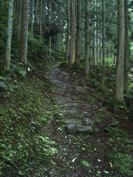
It was a slow ascent, but through pretty, shaded, slightly cooler woods; another old fellow on a Honda cub stopped to give me advice and encouragement. I nearly always found people to be very kind and helpful; it’s very cheering!

I also met these: mountain crabs! Yes, they exist. Fiesty little guys; if I stopped to take a picture, they would often come after me, waving their pincers! They’re quite quick; most of my photos of them are out of focus.

A rest stop for walking pilgrims at a spring. I drank at most of the ones I found, with no ill effects.

Sankakuji's Gate and bell tower. It's a very pretty temple.


Leaving the parking lot of Sankakuji, I took the small, dodgy looking, un-named road running high along the mountain, then down over route 5 near where the tunnel comes out, then up and down again to route 192, then right along that, up the valley east and south into the mountains. Long, brake burning downhills on some parts. It’s advisable to carry spare sets of brake pads; mine were worn almost to uselessness when I replaced them in Kochi.
Sakaime Tunnel was scary and dangerous. Many tunnels have wide sidewalks, but some, especially the older ones, have white lines more often than not 20 trash strewn inches from the concrete wall! A few times I felt lucky to make it through in one piece. No joke. Later, in one such tunnel I almost got smoked by a loaded logging truck.
Unpenji is on the mountains on the northern side of this valley. I turned left and upward at route 8, a steep but smaller, quieter road. After about 3 km. of climbing and right after another tunnel, I turned right onto a very small municipal road. It was paved, as practically all roads I’ve encountered in Japan are.

This little road climbed up to the spine of the mountain and then proceeded to run along the ridge for about 6 kilometers to Unpenji. It is quite steep in spots and I found myself walking a lot of it…

It does not seem traveled much; there is another, bigger road up to the temple further along the valley.

A few cars passed though. I smiled and waved, walked on. It was hot. Finally, after what seemed a very long journey, Unpenji’s gate appeared.

Relief. Unpenji has the reputation as being the toughest hike on the circuit for the arukihenro. It was a steep slog even riding up there, but I also saw some pretty views.

The temple itself is wonderful, surrounded by big (big!) trees, and boasts a beautiful statue of the reclining Buddha, surrounded by, I don’t know, perhaps 1,000 life size statues of enlightened beings (monks, I suppose) playing with various animal familiars like ryu-inu (dragon dogs).


The main road down from Unpenji, route 268, continued into the valley ahead, towards Tokushima. What looked like a separate road, however, smaller, branched off and led up and over the mountain on my left. I turned left. This was also route 268. On my map it showed, where it wasn’t obscured by an infobox about the Unpenji Ropeway, as a normal highway. Soon route 6 branched off, left again, showing as a small highway.

For the next hour, as I strained sweated and cursed my way up route 6, this road became smaller…and shabbier…and shabbier. Only a few cars passed, the drivers momentarily surprised, then passing on.

The woods became darker. I saw some bolete mushrooms growing. Some had been pulled out and chewed a bit, probably by deer.
 Just about the time the road started to level out into some sort of pass, I was questioning my decision to come up here. I stopped several times to look at my maps but couldn’t discern exactly where I was…but, bloody minded, continued guessing, going left at one unmapped fork.
A few minutes later, and I could tell that I had crossed the apex of the pass, and the road (miraculously!) was turning back into something resembling a normal, if small, highway. Coming away from Unpenji, I had dropped over into the valley on the southerly side of the mountain range and climbed back up; I was now about to drop back down the northern side. Which was good, as temple 66, Daikoji, was to the north.

The next half hour was a whoop! The highway, smooth pavement now, snaked and crossed back and forth in the narrow valley, dropping all the while.


 At one place I found this sedimentary rock cut. Some small coal seams, holes where someone had dug, very friable rock, no fossils, sigh.
Near the bottom, I found my way, via another municipal road, to route 240, and rode towards Daikoji.

But I bumped into this temple along the way...it's not on my list of bangai temples, so perhaps it is some commingling of jinja and Buddhist temple...no torii, however, just this red bell tower, the bell in the Buddhist style. I think it's called Daifukuji, though I don't know where I found that name (!). It also has a wooden statue of the little pilgrim guy used on the 88 temple circuit to indicate where to pray - but without the temple number usually written on his chest. As far a I can tell, this is not an 88 temple...it may be associated with temple 67, Daikoji.

A very well dressed statue of the pilgrim Kukai.
 Statues of o-Jiso-sama alongside one of the Shinto Seven Lucky gods. The deity shown here is Hotei, I think, also known as the Laughing Buddha, god of contentment. Imabari, where I lived, to the west, was historically a fishing village, and one of it's guardian shinto deities is Ebisu, the fisherman.
 A very Shinto shrine to happy marital life!
Daikoji has a nice old Kusunoki tree with a sacred rope around it. Workmen were trimming the hedges in the bottom, making a mess and a lot of noise.

 If I had elected to take the ropeway to Unpenji, I could have stayed on the north side of the mountains and accessing the temple would only have taken a short while; it’s perhaps 3 kilometers into the mountain from route 241; Daikoji is perhaps a further 8 km. by local road directly from the ropeway terminus. But I wouldn’t have missed these parts of the ride for anything.
A small Jinja in an empty lot. There's a big one across the street.
I stayed in a small family run hotel near the station, I believe it’s called the Park. Nice rooms, a restaurant, but no laundry facilities (so they claimed). Oh well.